
Tirages encadrés De MapSeeker
Impression encadrée de T045
Bienvenue dans la bibliothèque d'images de Mapseeker et entrez dans une passerelle historique vers l'une des plus grandes collections en ligne de cartes historiques, de vues nostalgiques, de panoramas d'un monde révolu.
Illustration fournie par MapSeeker
La combinaison choisie est réalisée rapidement et professionnellement sur commande., notre page sur l'expédition contient plus de détails
Si vous n'êtes pas entièrement satisfait de vos articles, il vous suffit de nous les renvoyer dans les 30 jours pour qu'ils soient remplacés ou intégralement remboursés. Veuillez lire notre politique de retour complète
ID des médias 20347654
DESCRIPTION VISUELLE
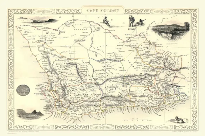
This historical map of the Cape Colony, likely dating back to the 19th century, provides a detailed representation of this significant region in South Africa during its colonial period. The map features intricate illustrations and annotations that highlight various geographical landmarks, towns, and routes. Key elements include: - **Topography**: The map showcases mountain ranges, rivers, and coastal lines with artistic flair typical of the era. - **Settlements**: Major cities and towns are marked clearly, indicating their importance within the colony's infrastructure. - **Transportation Routes**: Roads and pathways are illustrated in different colors or styles to signify travel routes used by settlers and traders. - **Illustrative Insets**: Decorative images around the borders depict local wildlife and landscapes, providing cultural context about the area’s natural beauty. Overall, this map serves as both a navigational tool from its time and an artistic representation of colonial ambitions in southern Africa. It reflects not only geographical information but also social dynamics during a period characterized by exploration and expansion.
Cadre en bois noir 15 x 10cm
Les tirages contemporains encadrés prêts à suspendre ajoutent du style, de la protection et une touche raffinée à votre espace, sans effort.
Votre maquette sera imprimée telle qu'elle apparaît dans l'aperçu. Pour l'ajuster, veuillez sélectionner Modifier l'image imprimée sous le bouton Acheter.
Notre photo 15x10cm encadrée en bois noir présente un élégant cadre en bois noir et votre photo est imprimée sur du papier Fujifilm Crystal Archive résistant à la décoloration, avec une plaque en verre acrylique incluse pour une protection supplémentaire. Remarque : les mesures fournies sont des dimensions extérieures estimées, qui comprennent à la fois l'image et le cadre. Bien que nous nous efforcions de maintenir des dimensions cohérentes, les dimensions exactes peuvent varier légèrement en raison de différences dans la taille de l'impression ou des exigences de production, ce qui peut entraîner une variation de la taille globale (jusqu'à environ 2,5 cm (1")).
Ces produits sont fabriqués individuellement, les tailles sont donc approximatives.
La taille estimée du produit est de 15.2cm x 10.2cm (6" x 4")
Présente dans ces collections
> Afrique > Afrique du Sud > Cartes
> Cartes et graphiques > Afrique